File:Northeast Asia at 900.png
Jump to navigation
Jump to search

Size of this preview: 800 × 549 pixels. Other resolutions: 320 × 220 pixels | 1,024 × 703 pixels.
Original file (1,024 × 703 pixels, file size: 1.37 MB, MIME type: image/png)
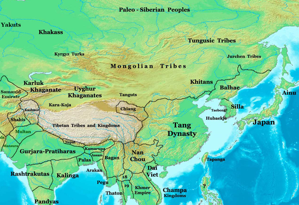
Map of Northeast Asia at 900 CE showing the location the Khitan in relation to China. Map by Talessman.
File history
Click on a date/time to view the file as it appeared at that time.
| Date/Time | Thumbnail | Dimensions | User | Comment | |
|---|---|---|---|---|---|
| current | 06:36, 10 April 2013 | | 1,024 × 703 (1.37 MB) | Emmanuel R (talk | contribs) | Map of Northeast Asia at 900 CE showing the location the Khitan in relation to China. Map by Talessman. |
You cannot overwrite this file.
File usage
There are no pages that use this file.